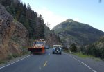
7th Annual Colorado Trail Run Report Pictures Maggie and Minnie Gulches
hagar
Old Time Jeeper
- Posts
- 1,172
- Thanks
- 5
- Location
- Riverside CA
- Vehicle(s)
- 47 CJ2A
225V6
SM420
D18 w/Warn overdrive
D30 5:38 Power Lok
D44 5:38 Flanged Detroit Locker
My wife and I attended this ride for the first time with this group.
We had decided prior that we were going to see different sites/trails that we had never been to/over before.
So when the trail ride schedule was announced, we saw a conflict with Black Bear/Imogene vs Maggie and Minnie Gulches.
While we had been over Black Bear and Imogene many times, we decided to go the different route. Black Bear and the others will still take your breath away every time you go over them; we were looking for something different.
So off we headed with Skeet and his wife Carolyn in their CJ7 and us in our CJ2a .
First we stopped and headed up Maggie Gulch.
Steep and very scenic, but not too rocky and challenging:
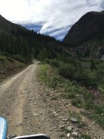
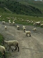
The first real obstacle encountered was a herd of sheep...a lot of sheep.
Idling along slowly and they finally yielded the right of way to us:
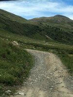
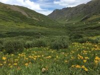
Of course, the wildflowers in this basin put on quite a show:
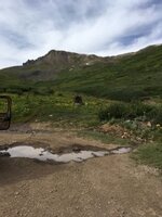
Finally, the end of the road, with old mining machinery in view:
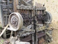
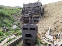
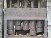
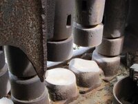
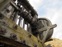
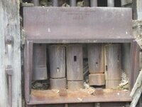
Closer inspection of a ravine below revealed a pair of stamp mills, still standing silently as if on guard; I love this old stuff, Made in America, and would really love to go back in time to hear the noise, sound and commotion
when all of this is in operation:
We left this site and climbed up another steep fork road to a metal building and some ruins. There was an open adit visible on the hillside with another narrow shelf road leading to it.
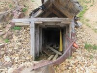
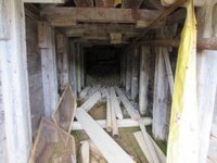
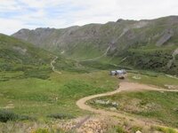
I drove up while Skeet waited below. I reached the adit and barely had enough room to turn the Jeep around. Here's a couple pics of the opening and then a pic of Skeet below in waiting. If you look closely in the top center of this phot you can see the size of the sheep herd.
Next we took on Minnie Gulch just a few miles away from Maggie Gulch.
This road was a little rougher and more challenging; keep in mind all pass roads are steep and require low range to crawl along comfortably.
We passed some mine and building ruins on the way up. Note the very tight switchback turn below.
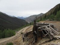
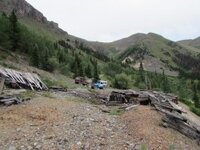
In the photo below and the one above, right of center, , you can see these old tailings farther up the canyon and on the side of the hill. We'll be visiting up there shortly:
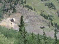
End of the road at those tailings:
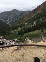
On the way back down, we took a short side road to a waterfall in the lower canyon. Can you spot Skeet in this photo ?
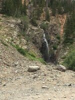
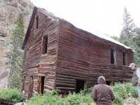
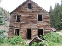
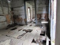
Also on the way down, we stopped to explore this fine building, maybe a boarding house for workers or even the mine owners home ?
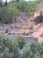
The remnants of a huge stamp mill were just a stone's throw downstream from the log building:
This concludes my report of exploring these two areas with another fine couple and fellow Jeepers, Skeet and Carolyn. I hope they enjoyed our company as my wife and I did theirs.
We had decided prior that we were going to see different sites/trails that we had never been to/over before.
So when the trail ride schedule was announced, we saw a conflict with Black Bear/Imogene vs Maggie and Minnie Gulches.
While we had been over Black Bear and Imogene many times, we decided to go the different route. Black Bear and the others will still take your breath away every time you go over them; we were looking for something different.
So off we headed with Skeet and his wife Carolyn in their CJ7 and us in our CJ2a .
First we stopped and headed up Maggie Gulch.
Steep and very scenic, but not too rocky and challenging:

The first real obstacle encountered was a herd of sheep...a lot of sheep.
Idling along slowly and they finally yielded the right of way to us:


Of course, the wildflowers in this basin put on quite a show:

Finally, the end of the road, with old mining machinery in view:

Closer inspection of a ravine below revealed a pair of stamp mills, still standing silently as if on guard; I love this old stuff, Made in America, and would really love to go back in time to hear the noise, sound and commotion
when all of this is in operation:


We left this site and climbed up another steep fork road to a metal building and some ruins. There was an open adit visible on the hillside with another narrow shelf road leading to it.
I drove up while Skeet waited below. I reached the adit and barely had enough room to turn the Jeep around. Here's a couple pics of the opening and then a pic of Skeet below in waiting. If you look closely in the top center of this phot you can see the size of the sheep herd.


Next we took on Minnie Gulch just a few miles away from Maggie Gulch.
This road was a little rougher and more challenging; keep in mind all pass roads are steep and require low range to crawl along comfortably.
We passed some mine and building ruins on the way up. Note the very tight switchback turn below.


In the photo below and the one above, right of center, , you can see these old tailings farther up the canyon and on the side of the hill. We'll be visiting up there shortly:

End of the road at those tailings:

On the way back down, we took a short side road to a waterfall in the lower canyon. Can you spot Skeet in this photo ?

Also on the way down, we stopped to explore this fine building, maybe a boarding house for workers or even the mine owners home ?


The remnants of a huge stamp mill were just a stone's throw downstream from the log building:

This concludes my report of exploring these two areas with another fine couple and fellow Jeepers, Skeet and Carolyn. I hope they enjoyed our company as my wife and I did theirs.
Last edited:

