Engineer & Corkscrew Pass in SW Colorado
BusaDave9
Always Off-Roading Jeeper
- Posts
- 8,248
- Media
- 360
- Resources
- 2
- Thanks
- 87
- Location
- Durango, Crawlarado
- Vehicle(s)
- 1979 Jeep CJ5 with 304 V8, T18 Transmission, Dana 20 Transfer case with TeraLow 3:1 gears, 4.88 axle gears, Detroit Locker up front and Ox Locker in back with 1 piece axle shafts, 36" SuperSwamper SX Tires, Shackle reversal, MileMarker Hydraulic winch, MSD 6A ignition.
Actually I went over Engineer Pass, California Pass, Hurricane Pass and Corkscrew Pass all without getting out of 4WD Low but that's too long for a thread title.
This route is what I plan on doing for the first day of the http://www.jeep-cj.com/forums/f100/2nd-annual-colorado-jeep-cj-com-trail-ride-12496/
I wanted to pre-run it to see how long it would take. I was worried the first day of the trail ride would be too long. After pulling off the highway I was in 4WD low 10:00 am to 3:40 pm.
Anyone interested in joining us on the 2nd Annual Colorado Jeep-CJ.com trail ride check out this link: http://www.jeep-cj.com/forums/f100/2nd-annual-colorado-jeep-cj-com-trail-ride-12496/
First off was Lower Engineer Pass trail. I love this trail. It's very rocky and slow going. It's not really too difficult but at times it is a little off camber to the downhill side.
Three miles south of Ouray I turned off of highway 550.
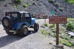
From here the trail starts off very rough.
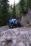
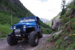
This next picture is looking back to highway 550.
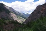
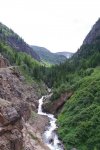
The road smooths out a bit where they built a shelf road. Great scenery but you better keep your eyes on the trail.
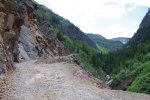
After half an hour I passed the fork that leads to Poughkeepsie Gulch. That's a fun but difficult trail. But today I plan on sticking with Engineer Pass trail.
Later as I rise I get a good view of Poughkeepsie Gulch:
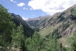
I decide to have lunch at Mineral Point. Mineral Point is an old mining camp at about the tree line.
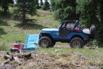
I brought my dog so at lunch time I give him a treat (milk bone) and myself a treat (a beer).
Shortly after lunch I get to a fork. The lower trail goes to Animas forks ghost town. But I take the higher road to the top of Engineer Pass. Here I can look back down on the trails around Mineral Point.
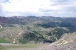
A little later we are on Engineer Pass. It looks like the top of the world. Here's a picture from the 1st Colorado Jeep-CJ.com trail ride.
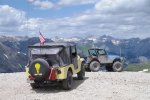
I backtrack a short distance down the same trail I came up. When I get back to the fork to Animas Forks i check my clock. Going to the top of Engineer Pass took 45 minutes.
I follow a rocky trail down to Animas Forks Ghost town. This was a mining town 100 years ago.
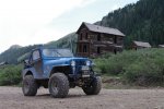
Here's my CJ at Animas Forks
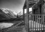
Animas Forks is known for this 2 story house with the bay windows.
Next I take a road that heads out the back of Animas Forks and into California Gulch. There I pass this mine:
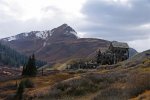
Here's another picture from California Gulch. I took this another year. There wasn't as much snow today.
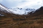
Here is California Pass (also shot another year)
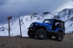
After California Pass I pass by the top of Poughkeepsie Gulch and it's just a few more minutes before I get to Hurricane pass. Most of the day has been spend above the tree line.
Here I am coming down from Hurricane Pass.

As soon as I get down to the tree line I climb back out of it as I ascend Corkscrew Pass. This trail is not as rocky. It gets dusty.
Here is a picture of last years Colorado trail ride at the top of Corkscrew Pass. Then we were going the opposite direction.
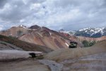
Here's my dog, Koda at Corkscrew Pass

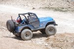
I continue on to highway 550 where I air up my tires and shift into 2WD.
That was just under 6 hours of four wheeling in 4WD low. That's what I plan on doing for the first day of http://www.jeep-cj.com/forums/f100/2nd-annual-colorado-jeep-cj-com-trail-ride-12496/
This route is what I plan on doing for the first day of the http://www.jeep-cj.com/forums/f100/2nd-annual-colorado-jeep-cj-com-trail-ride-12496/
I wanted to pre-run it to see how long it would take. I was worried the first day of the trail ride would be too long. After pulling off the highway I was in 4WD low 10:00 am to 3:40 pm.
Anyone interested in joining us on the 2nd Annual Colorado Jeep-CJ.com trail ride check out this link: http://www.jeep-cj.com/forums/f100/2nd-annual-colorado-jeep-cj-com-trail-ride-12496/
First off was Lower Engineer Pass trail. I love this trail. It's very rocky and slow going. It's not really too difficult but at times it is a little off camber to the downhill side.
Three miles south of Ouray I turned off of highway 550.

From here the trail starts off very rough.


This next picture is looking back to highway 550.


The road smooths out a bit where they built a shelf road. Great scenery but you better keep your eyes on the trail.

After half an hour I passed the fork that leads to Poughkeepsie Gulch. That's a fun but difficult trail. But today I plan on sticking with Engineer Pass trail.
Later as I rise I get a good view of Poughkeepsie Gulch:

I decide to have lunch at Mineral Point. Mineral Point is an old mining camp at about the tree line.

I brought my dog so at lunch time I give him a treat (milk bone) and myself a treat (a beer).
Shortly after lunch I get to a fork. The lower trail goes to Animas forks ghost town. But I take the higher road to the top of Engineer Pass. Here I can look back down on the trails around Mineral Point.

A little later we are on Engineer Pass. It looks like the top of the world. Here's a picture from the 1st Colorado Jeep-CJ.com trail ride.

I backtrack a short distance down the same trail I came up. When I get back to the fork to Animas Forks i check my clock. Going to the top of Engineer Pass took 45 minutes.
I follow a rocky trail down to Animas Forks Ghost town. This was a mining town 100 years ago.

Here's my CJ at Animas Forks

Animas Forks is known for this 2 story house with the bay windows.
Next I take a road that heads out the back of Animas Forks and into California Gulch. There I pass this mine:

Here's another picture from California Gulch. I took this another year. There wasn't as much snow today.

Here is California Pass (also shot another year)

After California Pass I pass by the top of Poughkeepsie Gulch and it's just a few more minutes before I get to Hurricane pass. Most of the day has been spend above the tree line.
Here I am coming down from Hurricane Pass.

As soon as I get down to the tree line I climb back out of it as I ascend Corkscrew Pass. This trail is not as rocky. It gets dusty.
Here is a picture of last years Colorado trail ride at the top of Corkscrew Pass. Then we were going the opposite direction.

Here's my dog, Koda at Corkscrew Pass


I continue on to highway 550 where I air up my tires and shift into 2WD.
That was just under 6 hours of four wheeling in 4WD low. That's what I plan on doing for the first day of http://www.jeep-cj.com/forums/f100/2nd-annual-colorado-jeep-cj-com-trail-ride-12496/
Last edited:

