Following the Oregon Trail in Oregon
hutchman
Jeeper
- Posts
- 88
- Media
- 4
- Thanks
- 1
- Location
- kennewick, wa
- Vehicle(s)
- 1986 CJ7 - 90,000 original unmolested and rust free miles - Stock - well almost.........
This post is a compilation of a few post on another sit concerning my interest in the Oregon Trail. It is posted in the hopes that some of you might enjoy it, although it has nothing to do with any of my Jeeps!
My search for the Oregon Trail has started. This past weekend I was fortunate enough to spend some time with my youngest son on the Snake River in Hells Canyon. On the way back home I took the time for some trail searching. This post will be the first of many, I hope, documenting my search for visible evidence of the Oregon Trail and highways/roads located on or near the trail.
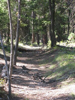
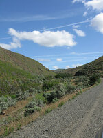
The first pictures were taken on the Sisley Creek Road just north of the Weatherby Rest area off of I-84. This road is located on top of the actual Trail. The emigrants used this route to get around Gold Mountain, which could not be climbed with the wagons and oxen.
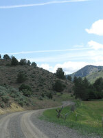
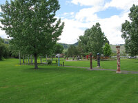
The next images were taken in Birnie Park on the south edge of La Grande, Or. It is a City Park situated on the location of an emigrant campground along side the OT. This park contains some excellent education info for kids and adults which makes it a good stop if you are following the Trail. The actual trail ran just to the left of this picture.
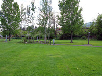
This picture was taken looking south from Birnie Park and shows "B" Avenue in La Grande going up the hill from left to right. The actual Trail runs under "B" Avenue.
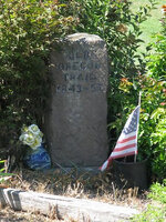
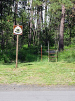
The next series of pictures was taken in the Deadman's Pass area along I-84. There are two rest areas at this exit, one for eastbound and one for westbound traffic. The first picture is of an Oregon Trail Marker located on the South side of the east bound rest area. Next to the marker there is a steel stairway over the fence leading to some visible Oregon Trail Swales. There are at least two sets and maybe more as it is hard to tell, but they are approximately 100 yards long.
These two images are of the actual swales, portions of which are visible without climbing over the fence.
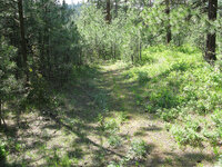
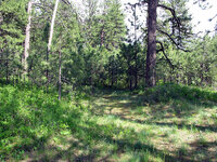
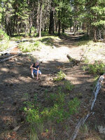
From this spot in the eastbound rest area, you can sight diagonally across I-84 to the south side of the other rest area and visualize the actual route of the Trail through the interchange. Located just to the south of the westbound rest area you can find these swales leading up the hill towards the Pendleton area. There appear to be at least two swales here.......one I am standing in while taking this picture and one just to the other side of the large tree. The tree is growing on the hump between the trails.
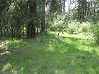
This next image was taken just slightly to the right of the last one and may show a third set of tracks leading up the same hill......I'm just not for sure. It is really hard to tell when standing there and even harder in the pictures!
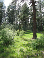
That was all for this trip, but I plan on taking my grandson on an Oregon Trail Discovery Trip this summer. We plan on doing a Power Point Presentation together so he can report on our trip for his history class next year. He is 9 years old and we are really looking forward to the trip. I also plan on updating this thread as time goes along with my "discoveries" of Oregon Trail history an actual swales.
Hutch
As stated above, earlier this summer, my grandson and I decided that we would follow the Oregon Trail for a summer adventure. Due to some family issues and Johnathon’s visits with his aunt, we did not get to start until 8-25. We started from his house in La Grande, OR early that morning and headed to Nyssa, OR. The trail crossed the Snake River from Fort Boise a few miles south of Nyssa and came right through here.
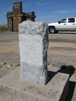
This was our first stop on the Trail and there is one of the many OR info kiosks here.....
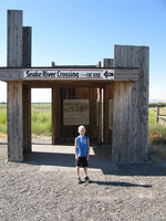
That is Johnathon ready for the adventure! There are also some barely visible ruts behind this marker heading up towards the southern OR desert.
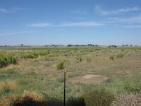
We followed some county roads up into the hills from here and ended up on the South Alternate Route of the Trail which intersects with the main trail several miles from here. This road is right on top of the SA Route. My guess is the pavement, corn, building and horse trailer were not here then.....
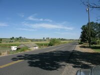
We headed up towards Keeny Pass and started seeing markers like these...
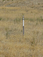
and ......
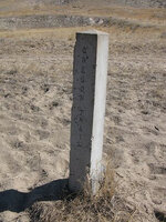
The brown markers have been placed by the Oregon and California Trails Association while the concrete ones are by the BLM. They mark the trail and are usually located in actual swales.
So you may ask yourself, what is a "swale?" I did .........
A swale is the rut made by the passage of wagons pulled by oxen. Today we think of an old country/dirt road as a couple of ruts the width of the average vehicle using the road. These "new" dirt roads have a raise center as there is nothing on that section - only under the wheels.
But in the old days, there were animals pulling the wagons. So not only did the trail wear under the wagon wheels, but also in the center where the animals walked. This resulted in "ruts" becoming a wide depression in the ground, slightly wider than the track of the wagon. Today they look like this.......
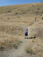
Johnathon is standing in a "swale" of the original trial at Keeney Pass. Just behind the one in which he is standing is another swale. One of the things you learn quickly is that these settlers did not like dust any better than we do and they spread out and go side-by-side when space permits.
Here is another picture from just up the hill showing the swales as they head up and over the hill towards what is now Vale, OR.
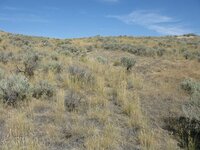
There is a pull off at Keeney Passs, which is where these pics were taken, where you can park and walk up to the top of the hill to get an idea of what a days travel was then. Looking east you can see back towards Fort Boise..
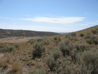
and west you look towards Vale......
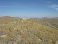
Several miles down the road is a sobering reminder of the reality of life and death on the trail.......
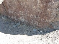
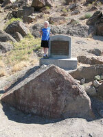
This was Johnathon's favorite part of the trip!
The marker states that John D. Henderson died on August 9, 1852. The original inscription that was scratched in the rock by the settlers is shown in the first picture. A historical marker about 100 yards from the actual grave, stated that he died of black measles. This is believed to be historically accurate. However, the new marker at the grave site states he died of thirst.
This falsehood was started in the 1930s by a third grader from Vale who wrote a paper stating John Henderson died of thirst when they were only 1/2 mile from the Malheur River. This story was passed on as true and was given as the reason for the death when the new marker was erected. Historical research has shown however that he really died of measles.
North of Vale we turned into the desert and followed a primitive road called "The Old Oregon Trail Road." It is the OT and follows the trail as it goes through the desert heading towards Farewell Bend.
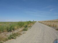
We followed this road for a couple of miles and were just getting to where we could really experience the desolation they must have felt when we came upon this.......
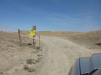
This gate is across a public road and it has a no trespassing sign. I do not think this is legal and asked a farmer that I ran into back towards town about it. He stated the road is open and could not be posted. I decided that I was not in familiar country and would be looked on as an outsider. In addition, I had my grandson with me and I did not want to set any kind of a bad example for him. We did not go pat the sign. Instead we backtracked and headed to Farewell Bend on the highway.
There was some good came out of this however, as we stopped at the Ontario airport and saw these.......



Even though we were more interested in older history, these gave us the chance to talk about Vietnam. Kind of interesting to see these one time adversaries next to each other.
Before we headed for Huntington, via old Route 30 we found these marked swailes SW of Farewell Bend State Park. They are up on the hill on the west side of I-84.
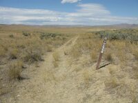
This view is NE towards Farewell Bend.......
The next picture is of Farewell Bend State Park. We had planned to camp here, but it was way too early in the day to stop.....
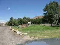
So we headed towards Huntington.
This view is looking back down the hill towards Farewell Bend SP. The trail runs to the right of the highway. They were heading into one of the toughest sections of the Trail at this point.
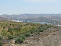
The view down towards Huntington.......
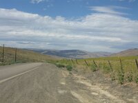
We ate a late lunch in Huntington at the old Streamliner Restaurant......
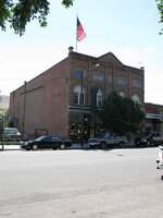
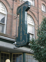
Now apparently known as Howells Cafe.......
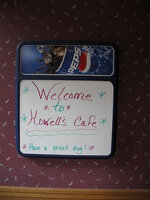
They have a killer hamburger, which I will review under a separate heading. Take my word........this place is worth a detour for a burger!
I am going to stop for now.....I am tired and it is late. More to come...
After leaving Huntington, the Trail mostly follows along the Burnt River. I sometimes was actually in the river as it was the flattest place to run the wagons. As an interesting sidelight...........following the actual Trail, one thing you tend to notice is the way these people managed to find the "easiest" route to follow. They were not civil engineers, but the people mapping the trail managed to find the route with the least slope to follow.
One reason for this is obviously the lack of pulling power. With two oxen and a heavy load, there is only so much incline that could be climbed, but the other issue is one I would never have thought of. These wagons were both tall and narrow, and because of this they had to go either straight up or straight down a hill. Otherwise they took a huge risk of rolling sideways down the hill. There just weren't any switch backs on any sections of the Trail that I have seen.
For going down steep hills they would lock the rear wheels with something like these:
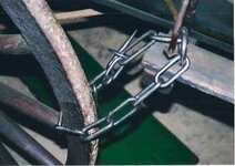
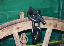
They would lock the rear wheel and slide down the hill to give themselves some control. These people were tough and found simple solutions to some tough problems.
Now back to the trip........
We are on Sisley Creek Road....I was on this one earlier in the summer. The first time, I missed a turn and did not get to follow it to the end, but this time we went all the way. Franzwa states in his booke that this is the worst part of the trip due to the road conditions, but it is easily doable in any family car. It is all gravel road.
At this point, we are on the OT. It runs under the modern road..
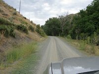
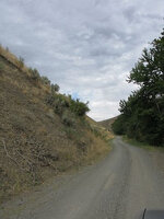
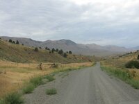
In this next image you can see the road below that we were on. You are looking back towards the Burnt River and the way they came from the Huntington area. It somewhere along here that they got their first view of the larger mountains to the West. They must have made a huge impression on the flatlanders.
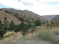
This next image is up on top of the hill as we come over the top. This is not exactly on the trail, it runs off to the right of this picture, but gives you some idea of what they were seeing.
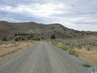
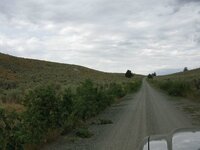
We are now down in the valley and back on the Trail again....
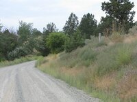
As you come down into the valley and rejoin the modern highway, you find an old log cabin.
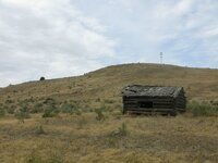
This cabin was the house of the teacher who taught in the school house on the other side of the road. Of course, I did not get a picture of the school.
At this point we got back on Old Hwy 30 and mostly drove. We did stop to take a couple of pics, but for the most part we were done for the day.....I was exhausted.
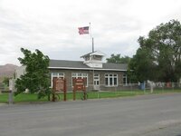
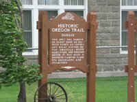
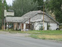
Look familiar Dave?!
North of Durkee Hwy 30 climbs out of the valley and so does the trail. In this picture there is a good set of ruts to the right of the road.......
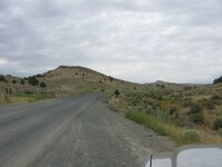
At this point, we decided to drive back to La Grande and stay at my son's house for the night. Sleeping on the ground in a rain storm just didn't seem to appealing. This was a great day and we saw a lot of history. More to come........
And as you can see, that was the end. I do plan to follow the trail from the Blue Mountains west to The Dalles, OR. From there the choice was to go down the Columbia River or after 1846, the Barlow Trail around Mt. Hood. I want to make this trip sometime in the near future.
My search for the Oregon Trail has started. This past weekend I was fortunate enough to spend some time with my youngest son on the Snake River in Hells Canyon. On the way back home I took the time for some trail searching. This post will be the first of many, I hope, documenting my search for visible evidence of the Oregon Trail and highways/roads located on or near the trail.
The first pictures were taken on the Sisley Creek Road just north of the Weatherby Rest area off of I-84. This road is located on top of the actual Trail. The emigrants used this route to get around Gold Mountain, which could not be climbed with the wagons and oxen.


The next images were taken in Birnie Park on the south edge of La Grande, Or. It is a City Park situated on the location of an emigrant campground along side the OT. This park contains some excellent education info for kids and adults which makes it a good stop if you are following the Trail. The actual trail ran just to the left of this picture.

This picture was taken looking south from Birnie Park and shows "B" Avenue in La Grande going up the hill from left to right. The actual Trail runs under "B" Avenue.

The next series of pictures was taken in the Deadman's Pass area along I-84. There are two rest areas at this exit, one for eastbound and one for westbound traffic. The first picture is of an Oregon Trail Marker located on the South side of the east bound rest area. Next to the marker there is a steel stairway over the fence leading to some visible Oregon Trail Swales. There are at least two sets and maybe more as it is hard to tell, but they are approximately 100 yards long.

These two images are of the actual swales, portions of which are visible without climbing over the fence.


From this spot in the eastbound rest area, you can sight diagonally across I-84 to the south side of the other rest area and visualize the actual route of the Trail through the interchange. Located just to the south of the westbound rest area you can find these swales leading up the hill towards the Pendleton area. There appear to be at least two swales here.......one I am standing in while taking this picture and one just to the other side of the large tree. The tree is growing on the hump between the trails.

This next image was taken just slightly to the right of the last one and may show a third set of tracks leading up the same hill......I'm just not for sure. It is really hard to tell when standing there and even harder in the pictures!

That was all for this trip, but I plan on taking my grandson on an Oregon Trail Discovery Trip this summer. We plan on doing a Power Point Presentation together so he can report on our trip for his history class next year. He is 9 years old and we are really looking forward to the trip. I also plan on updating this thread as time goes along with my "discoveries" of Oregon Trail history an actual swales.
Hutch
As stated above, earlier this summer, my grandson and I decided that we would follow the Oregon Trail for a summer adventure. Due to some family issues and Johnathon’s visits with his aunt, we did not get to start until 8-25. We started from his house in La Grande, OR early that morning and headed to Nyssa, OR. The trail crossed the Snake River from Fort Boise a few miles south of Nyssa and came right through here.

This was our first stop on the Trail and there is one of the many OR info kiosks here.....

That is Johnathon ready for the adventure! There are also some barely visible ruts behind this marker heading up towards the southern OR desert.

We followed some county roads up into the hills from here and ended up on the South Alternate Route of the Trail which intersects with the main trail several miles from here. This road is right on top of the SA Route. My guess is the pavement, corn, building and horse trailer were not here then.....

We headed up towards Keeny Pass and started seeing markers like these...

and ......

The brown markers have been placed by the Oregon and California Trails Association while the concrete ones are by the BLM. They mark the trail and are usually located in actual swales.
So you may ask yourself, what is a "swale?" I did .........
A swale is the rut made by the passage of wagons pulled by oxen. Today we think of an old country/dirt road as a couple of ruts the width of the average vehicle using the road. These "new" dirt roads have a raise center as there is nothing on that section - only under the wheels.
But in the old days, there were animals pulling the wagons. So not only did the trail wear under the wagon wheels, but also in the center where the animals walked. This resulted in "ruts" becoming a wide depression in the ground, slightly wider than the track of the wagon. Today they look like this.......

Johnathon is standing in a "swale" of the original trial at Keeney Pass. Just behind the one in which he is standing is another swale. One of the things you learn quickly is that these settlers did not like dust any better than we do and they spread out and go side-by-side when space permits.
Here is another picture from just up the hill showing the swales as they head up and over the hill towards what is now Vale, OR.

There is a pull off at Keeney Passs, which is where these pics were taken, where you can park and walk up to the top of the hill to get an idea of what a days travel was then. Looking east you can see back towards Fort Boise..

and west you look towards Vale......

Several miles down the road is a sobering reminder of the reality of life and death on the trail.......


This was Johnathon's favorite part of the trip!
The marker states that John D. Henderson died on August 9, 1852. The original inscription that was scratched in the rock by the settlers is shown in the first picture. A historical marker about 100 yards from the actual grave, stated that he died of black measles. This is believed to be historically accurate. However, the new marker at the grave site states he died of thirst.
This falsehood was started in the 1930s by a third grader from Vale who wrote a paper stating John Henderson died of thirst when they were only 1/2 mile from the Malheur River. This story was passed on as true and was given as the reason for the death when the new marker was erected. Historical research has shown however that he really died of measles.
North of Vale we turned into the desert and followed a primitive road called "The Old Oregon Trail Road." It is the OT and follows the trail as it goes through the desert heading towards Farewell Bend.

We followed this road for a couple of miles and were just getting to where we could really experience the desolation they must have felt when we came upon this.......

This gate is across a public road and it has a no trespassing sign. I do not think this is legal and asked a farmer that I ran into back towards town about it. He stated the road is open and could not be posted. I decided that I was not in familiar country and would be looked on as an outsider. In addition, I had my grandson with me and I did not want to set any kind of a bad example for him. We did not go pat the sign. Instead we backtracked and headed to Farewell Bend on the highway.
There was some good came out of this however, as we stopped at the Ontario airport and saw these.......


Even though we were more interested in older history, these gave us the chance to talk about Vietnam. Kind of interesting to see these one time adversaries next to each other.
Before we headed for Huntington, via old Route 30 we found these marked swailes SW of Farewell Bend State Park. They are up on the hill on the west side of I-84.

This view is NE towards Farewell Bend.......
The next picture is of Farewell Bend State Park. We had planned to camp here, but it was way too early in the day to stop.....

So we headed towards Huntington.
This view is looking back down the hill towards Farewell Bend SP. The trail runs to the right of the highway. They were heading into one of the toughest sections of the Trail at this point.

The view down towards Huntington.......

We ate a late lunch in Huntington at the old Streamliner Restaurant......


Now apparently known as Howells Cafe.......

They have a killer hamburger, which I will review under a separate heading. Take my word........this place is worth a detour for a burger!
I am going to stop for now.....I am tired and it is late. More to come...
After leaving Huntington, the Trail mostly follows along the Burnt River. I sometimes was actually in the river as it was the flattest place to run the wagons. As an interesting sidelight...........following the actual Trail, one thing you tend to notice is the way these people managed to find the "easiest" route to follow. They were not civil engineers, but the people mapping the trail managed to find the route with the least slope to follow.
One reason for this is obviously the lack of pulling power. With two oxen and a heavy load, there is only so much incline that could be climbed, but the other issue is one I would never have thought of. These wagons were both tall and narrow, and because of this they had to go either straight up or straight down a hill. Otherwise they took a huge risk of rolling sideways down the hill. There just weren't any switch backs on any sections of the Trail that I have seen.
For going down steep hills they would lock the rear wheels with something like these:


They would lock the rear wheel and slide down the hill to give themselves some control. These people were tough and found simple solutions to some tough problems.
Now back to the trip........
We are on Sisley Creek Road....I was on this one earlier in the summer. The first time, I missed a turn and did not get to follow it to the end, but this time we went all the way. Franzwa states in his booke that this is the worst part of the trip due to the road conditions, but it is easily doable in any family car. It is all gravel road.
At this point, we are on the OT. It runs under the modern road..


In this next image you can see the road below that we were on. You are looking back towards the Burnt River and the way they came from the Huntington area. It somewhere along here that they got their first view of the larger mountains to the West. They must have made a huge impression on the flatlanders.

This next image is up on top of the hill as we come over the top. This is not exactly on the trail, it runs off to the right of this picture, but gives you some idea of what they were seeing.


We are now down in the valley and back on the Trail again....


As you come down into the valley and rejoin the modern highway, you find an old log cabin.

This cabin was the house of the teacher who taught in the school house on the other side of the road. Of course, I did not get a picture of the school.
At this point we got back on Old Hwy 30 and mostly drove. We did stop to take a couple of pics, but for the most part we were done for the day.....I was exhausted.


Look familiar Dave?!
North of Durkee Hwy 30 climbs out of the valley and so does the trail. In this picture there is a good set of ruts to the right of the road.......

At this point, we decided to drive back to La Grande and stay at my son's house for the night. Sleeping on the ground in a rain storm just didn't seem to appealing. This was a great day and we saw a lot of history. More to come........
And as you can see, that was the end. I do plan to follow the trail from the Blue Mountains west to The Dalles, OR. From there the choice was to go down the Columbia River or after 1846, the Barlow Trail around Mt. Hood. I want to make this trip sometime in the near future.

