Kendall Mountain
BusaDave9
Always Off-Roading Jeeper
- Posts
- 8,248
- Media
- 360
- Resources
- 2
- Thanks
- 87
- Location
- Durango, Crawlarado
- Vehicle(s)
- 1979 Jeep CJ5 with 304 V8, T18 Transmission, Dana 20 Transfer case with TeraLow 3:1 gears, 4.88 axle gears, Detroit Locker up front and Ox Locker in back with 1 piece axle shafts, 36" SuperSwamper SX Tires, Shackle reversal, MileMarker Hydraulic winch, MSD 6A ignition.
A friend and I decided to check out the jeep trails near Silverton CO. We were hoping to go over BlackBear Pass but it's still closed due to snow. So instead we went up Kendall Mountain.
This first picture is looking across at highway 550 south of Silverton.
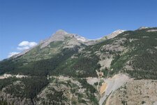
Kendall Mountain is right next to the town of Silverton.
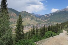
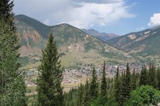
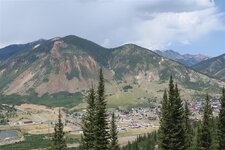
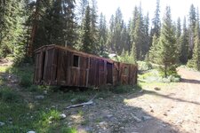
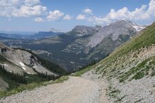
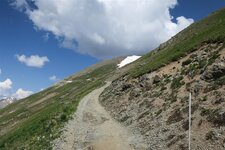
In Kendall Gulch there is a fork to the left. This goes to the top of Kendall Mountain. Now the trail gets narrow.
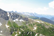
This next picture is of Kendall Gulch. We were on the trail below. You can see the fork we took on the left side of this picture.
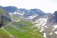
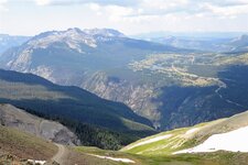
Near the top we were stopped by a snowfield. I parked my jeep at a ledge.
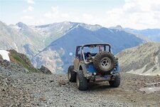
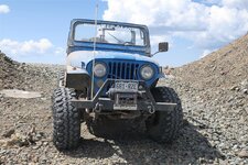
We took a short hike to the top of a minor summit on Kendall Mt.
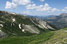
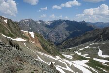
From here you can see the snowfield that stopped us just before the end of the trail.
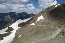
You can see the mountain peak in the upper right of the previous picture.
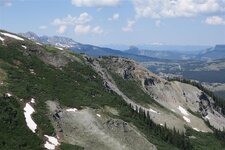
It's a gorgeous view from up here. THis next picture is looking back at Highway 550 going over Molas Pass just south of Silverton. The lake is Molas Lake.
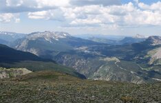
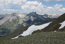
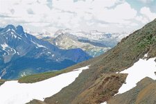
From the top I took this panorama. It's interactive so you can use your mouse to pan and look around.
Kendall Mt Panorama
For anyone that is interested in taking this trail, go through downtown Silverton. Turn right at 14th Street. This will take you on a bridge over the Animas River. Turn right after crossing the bridge. Now just follow the trail up the mountain. There are only 2 forks on this trail to worry about. After a relatively steep section with switchbacks you will get to the first fork. Keep left here. If you were to turn right you would go into Deer Park. The next fork is after you are in Kendall Gulch. In Kendall Gulch it looks like a dead end. You won't see the fork going to the left until you are upon it. After you turn left here the trail gets narrow and climbs right to the top of Kendall Mountain.
As I said earlier, I didn't make it to the end of the trail due to snow. If I were to make it around that last bend I would have had a great view down on the town of Silverton. Here's a picture I took a couple years ago:
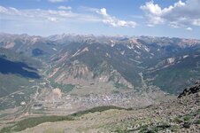
This first picture is looking across at highway 550 south of Silverton.

Kendall Mountain is right next to the town of Silverton.


In Kendall Gulch there is a fork to the left. This goes to the top of Kendall Mountain. Now the trail gets narrow.


This next picture is of Kendall Gulch. We were on the trail below. You can see the fork we took on the left side of this picture.


Near the top we were stopped by a snowfield. I parked my jeep at a ledge.


We took a short hike to the top of a minor summit on Kendall Mt.
From here you can see the snowfield that stopped us just before the end of the trail.

You can see the mountain peak in the upper right of the previous picture.
It's a gorgeous view from up here. THis next picture is looking back at Highway 550 going over Molas Pass just south of Silverton. The lake is Molas Lake.


From the top I took this panorama. It's interactive so you can use your mouse to pan and look around.
Kendall Mt Panorama
For anyone that is interested in taking this trail, go through downtown Silverton. Turn right at 14th Street. This will take you on a bridge over the Animas River. Turn right after crossing the bridge. Now just follow the trail up the mountain. There are only 2 forks on this trail to worry about. After a relatively steep section with switchbacks you will get to the first fork. Keep left here. If you were to turn right you would go into Deer Park. The next fork is after you are in Kendall Gulch. In Kendall Gulch it looks like a dead end. You won't see the fork going to the left until you are upon it. After you turn left here the trail gets narrow and climbs right to the top of Kendall Mountain.
As I said earlier, I didn't make it to the end of the trail due to snow. If I were to make it around that last bend I would have had a great view down on the town of Silverton. Here's a picture I took a couple years ago:


