Maggie Gulch & Minnie Gulch
BusaDave9
Always Off-Roading Jeeper
- Posts
- 8,248
- Media
- 360
- Resources
- 2
- Thanks
- 87
- Location
- Durango, Crawlarado
- Vehicle(s)
- 1979 Jeep CJ5 with 304 V8, T18 Transmission, Dana 20 Transfer case with TeraLow 3:1 gears, 4.88 axle gears, Detroit Locker up front and Ox Locker in back with 1 piece axle shafts, 36" SuperSwamper SX Tires, Shackle reversal, MileMarker Hydraulic winch, MSD 6A ignition.
I had the day off so I took my Jeep and my dog to Maggie Gulch & Minnie Gulch in the mountains north of Silverton. From my home in Durango I headed north for 50 miles to Silverton.
On the way I took this picture of Engineer Mountain.
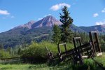
Engineer Mountain is a very recognizable mountain around here. It is just north of Durango Mountain Ski Resort.
Actually there are 2 Engineer Mountains. On our 2nd Annual Colorado Jeep-CJ.com trail ride we will be going over another Engineer Mountain.
After getting to Silverton I went through town and headed on county road 2. This starts off paved and then goes to gravel. About 4 miles north of Silverton I turn off onto a trail into Maggie Gulch.
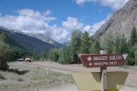
The above picture is looking back towards Silverton.
As you can see, the road is 2WD but when you turn off here you need to shift into 4WD.
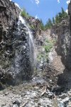
The trail goes along the north side of a canyon. Soon it opens up to this waterfall.
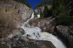
I shot this picture during the spring runoff. Today there wasn't as much water.
Near the waterfall there is a fork. First I took the lower road. It crosses the stream below the waterfall. It doesn't go very far up the other side of the stream.
Then I took the higher road. It is steeper and you want to look to make sure no one is coming down.
After you get above the waterfall it's not long before you get above the tree line.
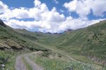
In the above picture I am not on the main trail. This side trail goes up to a mine. You can see the main trail goes up the gulch. That's the Continental Divide at the end of Maggie Gulch.
I got back on the main trail and just before the end of the main trail I took a fork that went across the creek and up the other side.
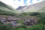
Here I found this old cabin.
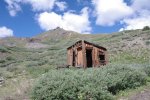
Here I stopped for lunch.

I took this picture from the same location looking back at the trail.
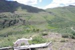
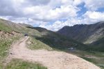
You can see the trails in the background. I came up from the left. In the middle of the picture above you can see a fork. If you go to the left it's not far to the end of the trail. I turned right and there are more trails to explore on the south side of the valley.
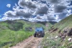
The above picture is HDR. There is a very steep drop off on the passenger side so I got out to make sure I had room to turn around if I continued. After a short walk I found this mine. It was a good place to turn around my CJ.
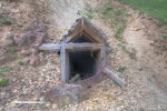
Here's another shot of the side of the valley.
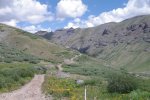
I shot this bulldozer in HDR.

I spent 3 hours exploring Maggie Gulch. Next I headed to the next valley Minnie Gulch.
These two gulches I get confused, Maggie and Minnie Gulches. I think they are similar. I was reading about a mining family that lived in both of these gulches. They had a daughter names Maggie and then another named Minnie. These 2 valleys were named after these daughters.
As I started up Minnie Gulch I passed the remains of a mill on the left. And then these cabins.
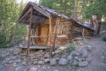
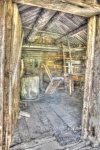
I took the above pictures last year. I didn't stop to reshoot these pictures.
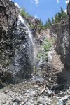
In Minnie Gulch I passed this waterfall.
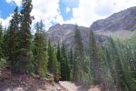
Here is the end of Minnie Gulch.
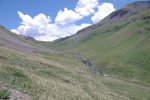
Both Maggie and Minnie Gulches go right up to the Continental Divide, high above the tree line but they are mild trails. A stock CJ can easily make it.
On the way I took this picture of Engineer Mountain.

Engineer Mountain is a very recognizable mountain around here. It is just north of Durango Mountain Ski Resort.
Actually there are 2 Engineer Mountains. On our 2nd Annual Colorado Jeep-CJ.com trail ride we will be going over another Engineer Mountain.
After getting to Silverton I went through town and headed on county road 2. This starts off paved and then goes to gravel. About 4 miles north of Silverton I turn off onto a trail into Maggie Gulch.

The above picture is looking back towards Silverton.
As you can see, the road is 2WD but when you turn off here you need to shift into 4WD.
The trail goes along the north side of a canyon. Soon it opens up to this waterfall.

I shot this picture during the spring runoff. Today there wasn't as much water.
Near the waterfall there is a fork. First I took the lower road. It crosses the stream below the waterfall. It doesn't go very far up the other side of the stream.
Then I took the higher road. It is steeper and you want to look to make sure no one is coming down.
After you get above the waterfall it's not long before you get above the tree line.

In the above picture I am not on the main trail. This side trail goes up to a mine. You can see the main trail goes up the gulch. That's the Continental Divide at the end of Maggie Gulch.
I got back on the main trail and just before the end of the main trail I took a fork that went across the creek and up the other side.

Here I found this old cabin.

Here I stopped for lunch.

I took this picture from the same location looking back at the trail.

You can see the trails in the background. I came up from the left. In the middle of the picture above you can see a fork. If you go to the left it's not far to the end of the trail. I turned right and there are more trails to explore on the south side of the valley.


The above picture is HDR. There is a very steep drop off on the passenger side so I got out to make sure I had room to turn around if I continued. After a short walk I found this mine. It was a good place to turn around my CJ.

Here's another shot of the side of the valley.

I shot this bulldozer in HDR.

I spent 3 hours exploring Maggie Gulch. Next I headed to the next valley Minnie Gulch.
These two gulches I get confused, Maggie and Minnie Gulches. I think they are similar. I was reading about a mining family that lived in both of these gulches. They had a daughter names Maggie and then another named Minnie. These 2 valleys were named after these daughters.
As I started up Minnie Gulch I passed the remains of a mill on the left. And then these cabins.


I took the above pictures last year. I didn't stop to reshoot these pictures.
In Minnie Gulch I passed this waterfall.


Here is the end of Minnie Gulch.

Both Maggie and Minnie Gulches go right up to the Continental Divide, high above the tree line but they are mild trails. A stock CJ can easily make it.
Last edited:


