Mountain Trails near Silverton Colorado
BusaDave9
Always Off-Roading Jeeper
- Posts
- 8,248
- Media
- 360
- Resources
- 2
- Thanks
- 87
- Location
- Durango, Crawlarado
- Vehicle(s)
- 1979 Jeep CJ5 with 304 V8, T18 Transmission, Dana 20 Transfer case with TeraLow 3:1 gears, 4.88 axle gears, Detroit Locker up front and Ox Locker in back with 1 piece axle shafts, 36" SuperSwamper SX Tires, Shackle reversal, MileMarker Hydraulic winch, MSD 6A ignition.
I just got back from the mountains surrounding Silverton CO. This is my favorite place to take my Jeep. Any Jeep-CJ.com members interested in coming here should check out our trail ride http://www.jeep-cj.com/forums/f63/jeep-cj-com-colorado-trail-ride-6722/
Silverton is in San Juan County. The entire county has a population of 688. No, I did not leave out a couple of zeros. Most of the people in the county live in Silverton. To get to Silverton you need to take highway 550. Whether you come from the north or the south highway 550 is often a ledge on a cliff.
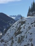
This shot is south of Silverton. The highway is the ledge near the top.
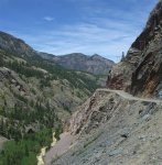
This shot is north of Silverton.
Although you can't tell in this low res image but there is a car wreck at the bottom of this canyon in the river. There are several car wrecks at the bottom of these ledges. These wrecks are all from the '50s and '60s. Nowadays they haul the wreckages back up. Back then they only brought the bodies up. There are many sections of this highway that don't have any guard rails. I often get behind someone that is obviously terrified of driving this highway. They go slow and drive far from the edge. They drive on the wrong side of the highway around curves they obviously cant see around. I guess they aren't as scared of head-on collisions as they are of falling off the ledge.
In the winter the population of Silverton drops to 15% the summer population. Anyone that wants to stay there for the winter knows there will be many times the highway will be closed. Highway 550 is known to have more avalanches than any any other stretch of highway in the US. They are often stranded for days or even weeks when the highway is closed.
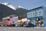
Here is downtown Silverton Colorado.
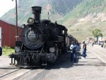
There is a Steam Train that brings tourists to and from Durango
I took my Jeep north from Silverton.
Here is an intersection that often gets people lost. Go north through downtown Silverton to this intersection.

Today I turned right onto Cty Rd 2. That leads to Animas Forks Ghost Town and the Alpine Loop.
If I were to continue strait the road goes up the hill and then to the left (NW) to Corkscrew pass.
There are countless mines in these mountains and several ghost towns. I passed through Eureka. This town-site only has one building that looks like a over-sized modern outhouse but I never did check it out.
Here is a picture of where a mill used to separate silver and gold from the raw ore.
You can easily drive a 2 wheel drive truck and trailer here. In late summer this area is full of large campers.
To continue you should lock your hubs and shift into four wheel drive. From here the Animas River valley becomes a canyon.
There are mines all over these mountains but most are no longer operating.
A few miles further you reach Animas Forks ghost town.
It always amazes me that people built a town up here so high in the mountains and stayed here year round.
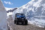
As you can see there is still plenty of snow in June.
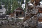
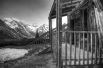
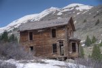
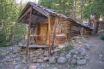
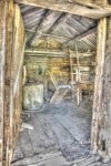
There is even a two story house with a bay window.
You have to be careful if you go into these houses. Many floor boards are missing and the ones that are still there can break easily.
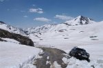
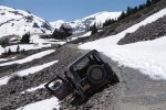
From Animas Forks I headed toward Engineer Pass. A bulldozer plows the trail but it wasn't clear all the way to the pass. I found this Toyota off the trail.
Two of his tires went off the trail and he tried to get back on by backing up. He ended up making it worse.
On the way down I went through Animas Forks again and saw this YJ off the trail.
The trail was narrow because of the snowbank. From the tracks I could tell the Jeep slid sideways as soon as the left 2 tires came off the trail. It must have been scary wondering if the Jeep would stop before it would roll over.
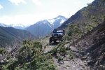
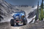
It may not sound like it but these are some easy trails in the summer. It's just that the snow drifts have made some trails very narrow.
Now I am thinking I need to find a place to camp. I head back toward Silverton for lower altitudes. I now consider 10,000 feet low altitude. I head up into Minnie Gulch. I know I am the first to make it up this trail when I blast through a couple of snow drifts. One snow drift takes me 3 tries. Then I get to get to this tree.
I saw it half way through and pull with my CJ until it broke. I decide this is where I want to camp. I always like the side trails the best. They are further away from people and that's why I head for the mountains.
Here is another picture of Minnie Gulch:

Sunday I took Cinnamon Pass.
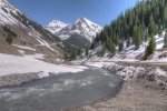
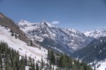
This is the view of Niagara Peak on the way to Cinnamon Pass.
The bulldozer has cleared the path.
This is now clear all the way to Lake City but I didn't go that far. As soon as the trail turned into a 2WD road I turned around.
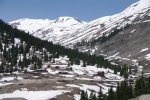
This picture is of American Basin. Later in the summer you can park in American Basin and climb Handies Peak. It's over 14,000 feet high.
If you're interested driving these trails check out the http://www.jeep-cj.com/forums/f63/jeep-cj-com-colorado-trail-ride-6722/
Silverton is in San Juan County. The entire county has a population of 688. No, I did not leave out a couple of zeros. Most of the people in the county live in Silverton. To get to Silverton you need to take highway 550. Whether you come from the north or the south highway 550 is often a ledge on a cliff.
This shot is south of Silverton. The highway is the ledge near the top.
This shot is north of Silverton.
Although you can't tell in this low res image but there is a car wreck at the bottom of this canyon in the river. There are several car wrecks at the bottom of these ledges. These wrecks are all from the '50s and '60s. Nowadays they haul the wreckages back up. Back then they only brought the bodies up. There are many sections of this highway that don't have any guard rails. I often get behind someone that is obviously terrified of driving this highway. They go slow and drive far from the edge. They drive on the wrong side of the highway around curves they obviously cant see around. I guess they aren't as scared of head-on collisions as they are of falling off the ledge.
In the winter the population of Silverton drops to 15% the summer population. Anyone that wants to stay there for the winter knows there will be many times the highway will be closed. Highway 550 is known to have more avalanches than any any other stretch of highway in the US. They are often stranded for days or even weeks when the highway is closed.
Here is downtown Silverton Colorado.
There is a Steam Train that brings tourists to and from Durango
I took my Jeep north from Silverton.
Here is an intersection that often gets people lost. Go north through downtown Silverton to this intersection.

If I were to continue strait the road goes up the hill and then to the left (NW) to Corkscrew pass.
There are countless mines in these mountains and several ghost towns. I passed through Eureka. This town-site only has one building that looks like a over-sized modern outhouse but I never did check it out.
Here is a picture of where a mill used to separate silver and gold from the raw ore.
You can easily drive a 2 wheel drive truck and trailer here. In late summer this area is full of large campers.
To continue you should lock your hubs and shift into four wheel drive. From here the Animas River valley becomes a canyon.
There are mines all over these mountains but most are no longer operating.
A few miles further you reach Animas Forks ghost town.
It always amazes me that people built a town up here so high in the mountains and stayed here year round.
As you can see there is still plenty of snow in June.
There is even a two story house with a bay window.
You have to be careful if you go into these houses. Many floor boards are missing and the ones that are still there can break easily.
From Animas Forks I headed toward Engineer Pass. A bulldozer plows the trail but it wasn't clear all the way to the pass. I found this Toyota off the trail.
Two of his tires went off the trail and he tried to get back on by backing up. He ended up making it worse.
On the way down I went through Animas Forks again and saw this YJ off the trail.
The trail was narrow because of the snowbank. From the tracks I could tell the Jeep slid sideways as soon as the left 2 tires came off the trail. It must have been scary wondering if the Jeep would stop before it would roll over.
It may not sound like it but these are some easy trails in the summer. It's just that the snow drifts have made some trails very narrow.
Now I am thinking I need to find a place to camp. I head back toward Silverton for lower altitudes. I now consider 10,000 feet low altitude. I head up into Minnie Gulch. I know I am the first to make it up this trail when I blast through a couple of snow drifts. One snow drift takes me 3 tries. Then I get to get to this tree.
I saw it half way through and pull with my CJ until it broke. I decide this is where I want to camp. I always like the side trails the best. They are further away from people and that's why I head for the mountains.
Here is another picture of Minnie Gulch:

This is the view of Niagara Peak on the way to Cinnamon Pass.
The bulldozer has cleared the path.
This is now clear all the way to Lake City but I didn't go that far. As soon as the trail turned into a 2WD road I turned around.
This picture is of American Basin. Later in the summer you can park in American Basin and climb Handies Peak. It's over 14,000 feet high.
If you're interested driving these trails check out the http://www.jeep-cj.com/forums/f63/jeep-cj-com-colorado-trail-ride-6722/
Last edited:

 Great pic's and trail report.

