southwest Montana's Tobacco Root Mountains
duffer
Active Jeeper
- Posts
- 469
- Media
- 9
- Thanks
- 32
- Location
- Bozeman, MT
- Vehicle(s)
- 1955 CJ3B: Dart/AFR aluminum 441 sbc, AGE M22W trans, "super" D18 w/ TeraLows & OD, FF44 PowrLoc Rear, D44 front-ARB/Reid/Dutchman, 4 wheel discs, York OBA, PP welder, 8274, glass/aluminum body, 33-12.5's;
1968 CJ5: all stock (V6/T86/D18) except 4bbl & headers and rear aux tank, HD rear 44 housing, Warn OD, Belleview winch;
2012 JKU Rubicon: Warn 9.5xp-s in Warn Elite, RSE rear bumper/tire carrier, Mopar lift, 35-12.5's, ARB OBA;
1947 2A and 49 3A that may or may not get built, and several FC/wagon derelicts
This post is an updated version of that I posted on Early CJ5 a couple years back. These mountains have been my favorite sandbox since I was a little kid many, many decades back a I feel very lucky to be living next door.
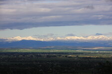
View of east flank, Lady of the Lake Peak/Mount Bradley on left, Hollowtop Mountain on right. Taken from my place about 30 miles east with Gallatin Valley in the middle.
South Meadow Creek, FS 1221. N45° 27.606', W111° 52.188' McAllister access off US 287. My stock JK Rubicon has no problems with it, but a couple of spots you need to pick the line well. Piece of cake for the 3B on 33's. Another trail (6361) branches to the north after the Missouri/McKee mine/mill and tops out on the ridge at South Baldy Mountain (10,105') with a loop option to take Trail 6362 back to the Washington Creek Road.
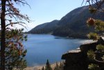
South Meadow Lake
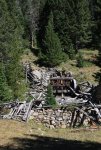
Missouri/McKee ruins
North Meadow Creek, FS 965/6338/6340. N45° 30.817', W111° 47.579' McAllister access or take Warm Springs Creek road over the Revenue Flats from Norris (US 287, MT 84). You might get a stock JK/TJ up these but highly likely they will not look too good after the run. Lots of boulders and tight spots and I'm going to say lockers and/or winch necessary but rewards are some great scenery. Lakes include Upper and Lower Twin Lakes, McKelvey, Cliff, Mine (on some maps Alpine), and Kid Lakes.
Lower Twin Lake
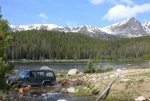
Upper Twin
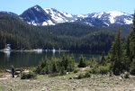
Cliff Lake
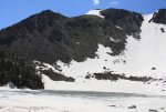
Un-named lake
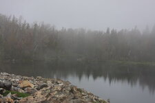
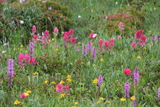
N. Meadow to S. Willow Creek, FS160, N45° 32.174', W111° 52.110' McAllister access. Only a couple miles of real Jeep trail-very steep and can get pretty muddy. A lot of gravel and semi-Jeep road on both ends.
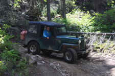
Top of divide between N. Meadow and S. Willow Creek-above Sureshot Lakes.
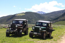
South Boulder River, FS 107. N45° 48.187', W111° 55.570' Cardwell access off I 90. Twenty something miles of gravel with about 4 miles good Jeep trail to Sailor Lake trail head (1/4 mile hike to lake-Trail 7140, another 1/4 mile hike to Globe Lake, and maybe 1.5 mile hike (Trail 7167) to Brannan Lakes. Hiking access to Louise, Curly and Lost Cabin Lakes also off this road. Road passes through the old Mining town of Mammoth.
Upper and Lower Brannan Lakes
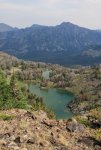
Curly Lake
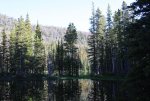
Sailor Lake-Mount Jackson
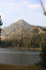
G bear sow/cubs at Globe Lake
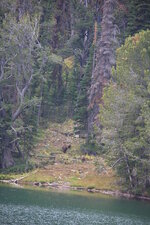
Mill Creek-Branham Lakes, FS 111, Sheridan access from US 287. FS 111 is a graded, maintained road and when snow free, doesn't require 4x4. Two developed campgrounds are along this route (Mill Creek and Balanced Rock) as is the Smuggler Mine which remains at least semi-active. A short 1.5 mile hike from the trailhead at Branham Lakes to Gneiss Lake.
Gneiss Lake/Legget Mountain
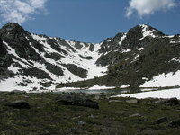
Miner cabin remains, S. Fork Mill Creek
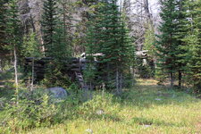
Wisconsin Creek/Noble Fork, FS 6370/8300/6015. N45° 27.585', W112° 11.836' Sheridan access from US 287. Another very scenic area with several lakes, including Crystal, Jackson, Sunrise, Noble, and Blossom. The only one you can directly drive to is Noble Lake. Stock Jeep can probably make all trails but on some reaches of the Noble Fork trail a little more clearance is highly desirable and there is one decent mud hole where lockers make life a little easier.
Noble Lake
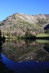
Blossom Lake
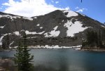
Mustard Pass (above Blossom Lake)-Rossiter Lake in background.
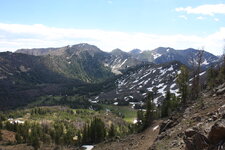
Dry Boulder Creek/Boulder Lakes, FS 1007. N45° 35.845', W112° 14.832' Twin Bridges access. Cake walk into lower Boulder Lake but trail from Lower to Upper Boulder Lake has a couple shelf's where you will want lockers on both ends or you will be running line.
Upper Boulder Lake
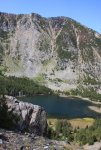
Indian Creek, FS 158. N45° 27.606', W112° 09.853' Sheridan access. Not too challanging but again, nice scenery. Used to be able to drive into Rossiter Lake but FS rebuilt the last 3 to 4 miles of trail for hiking only. Hill Reservoir (breached?-have seen no water in it for a number of years), Taylor Lake (swamp), Oval and Triangle Lakes (both small but nice) also up this drainage.
Rossiter Lake
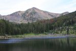
Pony/Windy Pass/N. Willow/Cataract Creek. N45° 39.540', W111° 54.AMC 232 i6 ' Many, many prospects and old mines, along with several remains of small mills. Some of this burned summer 2012 and I am not sure what is now open. Cataract Lake is a drive to, Upper and Lower Mason Lakes not much of a hike, but not much for lakes either.
Upper Mason Lake
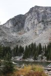
View of east flank, Lady of the Lake Peak/Mount Bradley on left, Hollowtop Mountain on right. Taken from my place about 30 miles east with Gallatin Valley in the middle.

South Meadow Creek, FS 1221. N45° 27.606', W111° 52.188' McAllister access off US 287. My stock JK Rubicon has no problems with it, but a couple of spots you need to pick the line well. Piece of cake for the 3B on 33's. Another trail (6361) branches to the north after the Missouri/McKee mine/mill and tops out on the ridge at South Baldy Mountain (10,105') with a loop option to take Trail 6362 back to the Washington Creek Road.
South Meadow Lake

Missouri/McKee ruins

North Meadow Creek, FS 965/6338/6340. N45° 30.817', W111° 47.579' McAllister access or take Warm Springs Creek road over the Revenue Flats from Norris (US 287, MT 84). You might get a stock JK/TJ up these but highly likely they will not look too good after the run. Lots of boulders and tight spots and I'm going to say lockers and/or winch necessary but rewards are some great scenery. Lakes include Upper and Lower Twin Lakes, McKelvey, Cliff, Mine (on some maps Alpine), and Kid Lakes.
Lower Twin Lake

Upper Twin

Cliff Lake

Un-named lake


N. Meadow to S. Willow Creek, FS160, N45° 32.174', W111° 52.110' McAllister access. Only a couple miles of real Jeep trail-very steep and can get pretty muddy. A lot of gravel and semi-Jeep road on both ends.

Top of divide between N. Meadow and S. Willow Creek-above Sureshot Lakes.

South Boulder River, FS 107. N45° 48.187', W111° 55.570' Cardwell access off I 90. Twenty something miles of gravel with about 4 miles good Jeep trail to Sailor Lake trail head (1/4 mile hike to lake-Trail 7140, another 1/4 mile hike to Globe Lake, and maybe 1.5 mile hike (Trail 7167) to Brannan Lakes. Hiking access to Louise, Curly and Lost Cabin Lakes also off this road. Road passes through the old Mining town of Mammoth.
Upper and Lower Brannan Lakes

Curly Lake

Sailor Lake-Mount Jackson

G bear sow/cubs at Globe Lake

Mill Creek-Branham Lakes, FS 111, Sheridan access from US 287. FS 111 is a graded, maintained road and when snow free, doesn't require 4x4. Two developed campgrounds are along this route (Mill Creek and Balanced Rock) as is the Smuggler Mine which remains at least semi-active. A short 1.5 mile hike from the trailhead at Branham Lakes to Gneiss Lake.
Gneiss Lake/Legget Mountain

Miner cabin remains, S. Fork Mill Creek

Wisconsin Creek/Noble Fork, FS 6370/8300/6015. N45° 27.585', W112° 11.836' Sheridan access from US 287. Another very scenic area with several lakes, including Crystal, Jackson, Sunrise, Noble, and Blossom. The only one you can directly drive to is Noble Lake. Stock Jeep can probably make all trails but on some reaches of the Noble Fork trail a little more clearance is highly desirable and there is one decent mud hole where lockers make life a little easier.
Noble Lake

Blossom Lake

Mustard Pass (above Blossom Lake)-Rossiter Lake in background.

Dry Boulder Creek/Boulder Lakes, FS 1007. N45° 35.845', W112° 14.832' Twin Bridges access. Cake walk into lower Boulder Lake but trail from Lower to Upper Boulder Lake has a couple shelf's where you will want lockers on both ends or you will be running line.
Upper Boulder Lake

Indian Creek, FS 158. N45° 27.606', W112° 09.853' Sheridan access. Not too challanging but again, nice scenery. Used to be able to drive into Rossiter Lake but FS rebuilt the last 3 to 4 miles of trail for hiking only. Hill Reservoir (breached?-have seen no water in it for a number of years), Taylor Lake (swamp), Oval and Triangle Lakes (both small but nice) also up this drainage.
Rossiter Lake

Pony/Windy Pass/N. Willow/Cataract Creek. N45° 39.540', W111° 54.AMC 232 i6 ' Many, many prospects and old mines, along with several remains of small mills. Some of this burned summer 2012 and I am not sure what is now open. Cataract Lake is a drive to, Upper and Lower Mason Lakes not much of a hike, but not much for lakes either.
Upper Mason Lake

Last edited:


 :drool:

