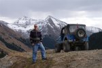
Beartown Site, Wager Gulch & Carson City Ghost Town
BusaDave9
Always Off-Roading Jeeper
- Posts
- 8,248
- Media
- 360
- Resources
- 2
- Thanks
- 87
- Location
- Durango, Crawlarado
- Vehicle(s)
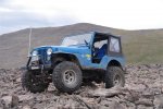
- 1979 Jeep CJ5 with 304 V8, T18 Transmission, Dana 20 Transfer case with TeraLow 3:1 gears, 4.88 axle gears, Detroit Locker up front and Ox Locker in back with 1 piece axle shafts, 36" SuperSwamper SX Tires, Shackle reversal, MileMarker Hydraulic winch, MSD 6A ignition.
I planned this trip to camp at Beartown site but I took the long way to get there. Before going to Beartown I wanted to go to Carson City Ghost Town and over the nearby mountain pass.
I started my trip at Silverton CO and gassed up. I need lots of gas for this trip. The mountain pass above Carson City Ghost Town is very remote. The first time I tried this route I realized I didn't have enough gas to continue. So I had to turn back. This time I was prepared. I have since installed a 21 gallon tank plus I have 6 extra gallons on board.
From Silverton I headed into the mountains and took Cinnamon Pass. Here is a picture I already posted from another trip of American Basin near Cinnamon Pass.
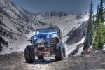
32 miles from Silverton, just when the trail started to get mild I turned onto the trail to Carson City Ghost town.
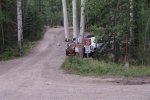
This is on the Alpine Loop. If you are coming from the east you can get to this trailhead in 2WD. From this point the trail climbs steeply.
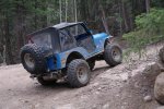
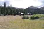
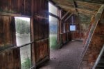
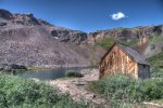
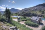
After 4 miles I arrive at Carson City Ghost Town.
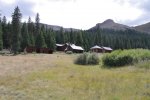
I stop here for lunch (sandwiches).
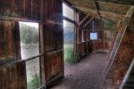
From Carson City I headed up over the Continental Divide. This is the remote pass that necessitated me carrying extra gas. This pass really doesn't head anywhere in particular. I still have a maze of trails and roads to get to Stony Pass Trail. That's where I will find the trail to Beartown Site.
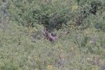
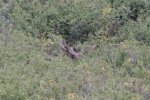
At 12,000 feet I see this Moose. I never realized moose came up this high.
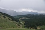
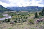
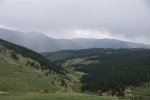
As I approach the Continental Divide I look back. Carson City is on the right side of this valley below.
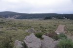
The weather is not looking good so I stay moving. At the top, the trail follows the Continental Divide but the weather starts to clear up. I cross this rock field.
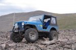
Signs of civilization again!
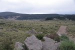
If anyone plans on following my route, take a good look at the above picture. When I first tried this route I followed the trail right up to those houses but was stopped by a gate that said "Private Property, No Trespassing". I knew I must have missed a turn off. In the picture above the correct trail is in the hills to the right. I backtracked to find the fork.
I got onto highway 149 and followed it 3.5 miles south. I turned onto the road to the Rio Grande Reservoir. This is also Stony Pass Trail.
Here is the Rio Grande Reservoir.
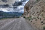
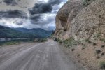
As you can see it's a gravel road and 4wd is not necessary until you pass the reservoir.
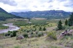
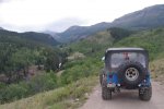
This trail has lots of stream crossings. Some of these crossings can be treacherous but today the water levels are very low.
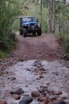
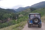
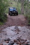
Now things get interesting. This next picture is the beginning of Timber Hill. I like this part. It's a narrow steep rocky trail. I need to turn right.
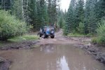
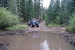
The above picture looks like a mud puddle but it's actually a stream, just not flowing much today.
Then the valley widens out and I follow Bear Creek up to Beartown site. There are no more buildings left to the town. I set up camp.
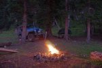
The sun is behind the mountains and I want to setup the tent before it gets too dark.
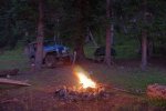
I have traveled 94 miles since I fueled up in Silverton. Only 3.5 miles were on pavement. My gas gauge is pointing strait at empty. I put all my spare gas in the tank. I am wondering (hoping) it's enough to get to Silverton. As I mentioned before I took the very long way to get here. The shortest path back to Silverton is over Stony pass.
My CJ5 got 6.8 MPG. Not too bad considering I was aired down to 9 psi most of the time. On the highway I usually get 13 mpg.
I started my trip at Silverton CO and gassed up. I need lots of gas for this trip. The mountain pass above Carson City Ghost Town is very remote. The first time I tried this route I realized I didn't have enough gas to continue. So I had to turn back. This time I was prepared. I have since installed a 21 gallon tank plus I have 6 extra gallons on board.
From Silverton I headed into the mountains and took Cinnamon Pass. Here is a picture I already posted from another trip of American Basin near Cinnamon Pass.

32 miles from Silverton, just when the trail started to get mild I turned onto the trail to Carson City Ghost town.

This is on the Alpine Loop. If you are coming from the east you can get to this trailhead in 2WD. From this point the trail climbs steeply.

After 4 miles I arrive at Carson City Ghost Town.

I stop here for lunch (sandwiches).

From Carson City I headed up over the Continental Divide. This is the remote pass that necessitated me carrying extra gas. This pass really doesn't head anywhere in particular. I still have a maze of trails and roads to get to Stony Pass Trail. That's where I will find the trail to Beartown Site.
At 12,000 feet I see this Moose. I never realized moose came up this high.

As I approach the Continental Divide I look back. Carson City is on the right side of this valley below.

The weather is not looking good so I stay moving. At the top, the trail follows the Continental Divide but the weather starts to clear up. I cross this rock field.

Signs of civilization again!

If anyone plans on following my route, take a good look at the above picture. When I first tried this route I followed the trail right up to those houses but was stopped by a gate that said "Private Property, No Trespassing". I knew I must have missed a turn off. In the picture above the correct trail is in the hills to the right. I backtracked to find the fork.
I got onto highway 149 and followed it 3.5 miles south. I turned onto the road to the Rio Grande Reservoir. This is also Stony Pass Trail.
Here is the Rio Grande Reservoir.

As you can see it's a gravel road and 4wd is not necessary until you pass the reservoir.


This trail has lots of stream crossings. Some of these crossings can be treacherous but today the water levels are very low.

Now things get interesting. This next picture is the beginning of Timber Hill. I like this part. It's a narrow steep rocky trail. I need to turn right.

The above picture looks like a mud puddle but it's actually a stream, just not flowing much today.
Then the valley widens out and I follow Bear Creek up to Beartown site. There are no more buildings left to the town. I set up camp.
The sun is behind the mountains and I want to setup the tent before it gets too dark.

I have traveled 94 miles since I fueled up in Silverton. Only 3.5 miles were on pavement. My gas gauge is pointing strait at empty. I put all my spare gas in the tank. I am wondering (hoping) it's enough to get to Silverton. As I mentioned before I took the very long way to get here. The shortest path back to Silverton is over Stony pass.
My CJ5 got 6.8 MPG. Not too bad considering I was aired down to 9 psi most of the time. On the highway I usually get 13 mpg.
Last edited:


 As always!