2nd Annual Colorado Jeep-CJ.com Trail Report

2nd Annual Colorado Jeep-CJ.com Trail Report

BusaDave9

Always Off-Roading Jeeper
Posts
8,244
Thanks
81
Location
Durango, Crawlarado
Vehicle(s)
1979 Jeep CJ5 with 304 V8, T18 Transmission, Dana 20 Transfer case with TeraLow 3:1 gears, 4.88 axle gears, Detroit Locker up front and Ox Locker in back with 1 piece axle shafts, 36" SuperSwamper SX Tires, Shackle reversal, MileMarker Hydraulic winch, MSD 6A ignition.
2nd Annual Colorado Jeep-CJ.com Trail Ride Report
Arrival Day
August 26, 2012

We had a lot of enthusiasm about the Colorado Trail ride but after a couple of cancellations we had only 3 members show up for the trail ride. There are very few members living near here and it's a big job to transport a CJ long distances.
jeep_cj_group_shot.jpg

IOPort51's 1977 CJ5, djohnbb62's 1964 CJ5, BusaDave9's 1979 CJ5
All the CJ's were CJ5's
I arrived in Ouray CO on Sunday. Ouray is in a box canyon and surrounded by very steep, tall cliffs.
arrival_day-090_ouray.jpg


arrival_day_ouray_091.jpg

IO ran into a delay getting into town so I ate dinner without him at O'Brians Pub.
arrival_day_ouray.jpg

 
Last edited:
Day 1

Day 1
August 27, 2012

Engineer Pass
California Pass
Hurricane Pass
Corkscrew Pass


From Ouray we headed 4 miles south of town before turning onto Lower Engineer Pass trail and locking our hubs. I also aired down to 8 psi. This trail is very rough and rocky.
day1-003_lower_engineer_pass_trail.jpg

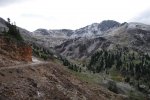
The valley in the background of this next pic is the north end of Poughkeepsie Gulch. It's a difficult trail we plan on going on Thursday.
day1-007_lower_engineer_pass_trail__poughkeepsie_gulch_in_background.jpg

This next picture is descending down on Animas Forks Ghost Town.
day1-027.jpg

Continuing behind Animas Forks there is this old mine in California Gulch
day1-033.jpg


day1-036_california_gulch_mine.jpg


day1-039_california_gulch_mine.jpg

At the end of California Gulch the trail climbs to California pass and after a short distance Hurricane Pass.
This next pic is Lake Como. This is the south end of Poughkeepsie Gulch.
day1-081_lake_como.jpg

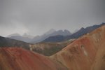
Next was Corkscrew Pass that goes among the Red Mountains. The high iron content gives them the red color. There are 3 Red Mountains.
day_1-088_corkscrew_pass.jpg

Corkscrew pass ends at highway 550 where I aired back up. Eight more miles and I was back in Ouray.
I got separated from IO and later met up with him in Ouray.

I really like the route of today's trail ride. I plan on including it in the 3rd Annual Colorado Trail ride. It includes 4 high mountain passes, a ghost town and it is a loop, you never go over the same trail twice.
 
Last edited:
Black Bear Pass

Day 2
Aug. 28, 2012

Black Bear Pass

Tuesday me and IO headed south of Ouray to Red Mountain Pass. At the summit of the pass we locked our hubs and shifted into 4WD Low but we still have a lot of climbing to get to the top of Black Bear Pass. We were both very excited but we also had butterflies in our stomach knowing this is a difficult trail going down a 3000 foot cliff. Off-roaders have fallen 1000 feet when they have gone off this trail.
day2-005_start_of_bb_pass.jpg

We stopped part way up our assent to take in the view.
day2-012_black_bear_road.jpg

I was bringing along my dog Koda. That is highway 550 far below and to the right.
day2-015_koda_over_red_mountain_pass.jpg

Before encountering any difficult obstacles we reach the 12,840 foot high summit.
day2-020.jpg


day2-021_blackbear_pass_tonemapped.jpg

Looking over the pass this is the direction we need to go.
day2-019.jpg

As we start to go down we approach Ingram Lake.
day2-030_black_bear_pass.jpg

At the first obstacle there are a couple of routes. I try going down a steep ledge and my tires slip and I hit the bottom of the ledge harder than I would have liked. I didn't want to give IO the impression I knew what I was doing so I CB radioed "I'm not sure I took the best route"
IO looked over the alternate route. It was very off-camber tilting to the side. Thinking it would be better to fall forward rather than sideways IO takes the same route I did.
day2-040_black_bear_pass.jpg


day2-037_black_bear_pass.jpg

As we start to descend we get to a sign saying the trail begins one-way. To continue we must go on to Tellurium. This is the point of no return.
day2-045_black_bear_pass.jpg

Now things are really getting tricky. Picking the correct line is important going over these obstacles. This rocky trail is often off-camber tilting you toward the ledge.

day2-054_black_bear_pass.jpg

In the above picture you can see it would be easy to fall into the waterfall. Later when I mentioned this to IO he said he didn't remember the waterfall. Going over this trail you get tunnel vision looking at every rock your tire may run over and you don't get much chance to look at the scenery.
day2-060_black_bear_pass.jpg

Next we started to descend the cliff. This section is scary but, fortunately the obstacle are not as difficult.
This next picture is from a previous ride down Black Bear Pass. The nearest tree is 1000 feet below my jeep.
1000_foot_drop_at_black_bear.jpg

Now this trail has some extremely tight switchbacks. Even in a CJ5 you must make several maneuvers to turn the jeep around. You get the nose as close to the edge as you dare and then you back up.
This next picture is also from another trip over Black Bear Pass.
398__small.jpg

After we reach the bottom of the mountain we drive the short distance into Telluride.

I am thinking of having a 3rd Colorado Trail Ride next year. I always pick the trails based on the suggestions of the participants. IO suggested Black Bear Pass for this year and I really hope to include it in next year's trail ride. If you would like to participate next year but don't want to do Black Bear or the more difficult trails let me know.
 
Last edited:
Imogene Pass

Continuation of
Day 2
Aug. 28, 2012

Imogene Pass


After arriving in Telluride we bought a couple of T-shirts. Upon hearing thunder we knew we needed to start heading back. Since Black Bear Pass is one way we needed to take Imogene Pass over the mountains to get back to Ouray.

To get to Imogene Pass you need to take Oak Street. Now Oak Street is not a through street that intersects Main so you need to look for the Courthouse with the clock.
41861226.jpg

Behind the Courthouse is Oak Street that will take you to Imogene Pass Road. Confusing? Yes. Plus there are no signs. I really don't think Telluride wants to make it too easy for the off-roaders.
As we climb Imogene Pass road we go through Bullion Tunnel.
day2-081_imogene_pass.jpg

When we reach Tomboy Mine it starts to rain.
day2-084_imogene_pass.jpg


day2-086_imogene_pass.jpg

It continues to rain lightly as we crest Imogene Pass.
day2-089_imogene_pass.jpg

day2-091_imogene_pass.jpg

At places above the tree line it almost looks like a moonscape.
day2-096_imogene_pass.jpg

Here is IO crossing Imogene Creek
day2-100_imogene_pass.jpg


This trail ends up dropping us off right in Ouray, which was relatively convenient. I say relatively because it took us it took us 9 hours to complete Black Bear Pass and get back to Ouray via Imogene Pass. A very long day of four wheeling.
This is a must do trail ride for anyone planning to jeep in SW Colorado. I'm really not sure how to shorten it. Once you get to Telluride you need to come back and there aren't any east to west routes near Telluride or Ouray. If you were to take the highway you could head northwest from Telluride then northeast to Ridgeway and then south to Ouray.
 
Last edited:
US Basin Road & Clear Lake

Day 3
Aug. 29, 2012

US Basin Road
Clear Lake


Wednesday, me, Larry(IOPort51) and Dan(djohnbb62) headed out on the trails.

I never know what to call this first trail we took. I think the best name is US Basin Road. It descends through Browns Gulch so some people call it that. The southern part of this same trail is also called Brooklyn Trail. This is a very mild trail. It is a very high altitude trail far above highway 550. The thing I like about it is it has a beautiful view.
day3-01.jpg


day3-03.jpg

We stopped to take pictures and IO's radiator started to boil over. We took it easy the rest of the day and IO's CJ made it just fine.
We got back on the highway and closer to Silverton we turned off the highway again. We shifted back into 4WD low and climbed again. This time we were heading toward Clear Lake.
day3-11.jpg

This next picture is a pond we encountered just before Clear Lake.
day3-12.jpg

I had to take a few group shots of the Jeep-CJ5.com trail ride.
day3-13_group_shot.jpg

day3-15_group_shot.jpg

day3-19_group_shot_at_clear_lake.jpg

After a short lunch of sandwiches we started back.
Here is IO's CJ5 descending from Clear Lake.
day3-22.jpg

 
Last edited:
Poughkeepsie Gulch

Day 4
Aug. 30, 2012

Poughkeepsie Gulch

Thursday we have Poughkeepsie Gulch planed. IO's CJ5 has had some overheating problems and didn't join me for Poughkeepsie Gulch.

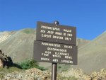
Poughkeepsie Gulch is one of the more difficult trails around. You need lockers to finish this trail.
PoughkeepsieGulchSignSmall.jpg
To get to Poughkeepsie Gulch I started off on Lower Engineer Pass trail. I turned off of highway 550 the same as the first day of trail rides. After a couple of miles I got to the fork that leads off to Poughkeepsie Gulch.
The trail starts off mild. I cross a stream. There are lots of rocks but the trail still isn't difficult (yet).
day4-07_poughkeepsie_gulch.jpg

The rocks start to get bigger, making the trail a little more difficult.
day4-12_poughkeepsie_gulch.jpg


day4-15_poughkeepsie_gulch.jpg


day4-17_poughkeepsie_gulch.jpg

These trails always seem to change in difficulty. Black Bear & Poughkeepsie both seamed harder this year. The hardest part of Poughkeepsie gulch is always the rock ledge at the top (sometimes called the Wall).
attachment.php

not my jeep. not my picture.
The above picture is the Wall. There is another smaller ledge below the wall. I didn't even remember this lower ledge. Maybe it is now more pronounced with erosion at the base of the lower ledge. I have installed an off-road kit in my Edelbrock carburetor that has worked good but I did stall out twice today on Poughkeepsie. The first time was on the lower ledge under the wall. After restarting my CJ I made it up the ledge and then the wall.

After the wall the trail often split up. At one point I realized I was taking the hard route. I thought to myself I should backup and take the easy fork. I got to thinking I should be able to make it after locking my OX. It was a steep rocky ledge with some loose rocks. My nose pointed upward as I started the steep climb and my front left tire started to take for the air. Just then my right rear tire fell into a hole making my CJ point even steeper and my engine died. As my jeep lurched back from the dying engine the front tire went even higher into the air. I was thinking to myself "DON'T ROLL, DON'T ROLL, DON'T ROLL" I later remembered IO's signature line "We remember the times, when the voice in our head was screaming like a little girl." I only hope that little girl voice stayed inside my head.
I started up my jeep and backed up only enough to bring my tire out of the hole. After reassessing the situation I decided I would be better off steering slightly to the right. I also put a big rock in the hole just in case I fell into it again.
That's the last time I will ever let Koda spot for me.
After Poughkeepsie Gulch I went over Hurricane Pass. I found a spur going to the backside of Hurricane Peak.
day4-40_red_mountains.jpg

The distant trail in the above picture is Corkscrew Pass. That's where I will need to head.
Then it started to hail. I had my lunch and the hail stopped after half an hour. By that time there was almost 2 inches of hail over the ground.
day4-42_hail_at_sunnyside_saddle.jpg

As I headed toward Corkscrew Pass I took this picture.
Day4-48BonitaPeakandHurricanePassRoad.jpg
I was at the distant mountain when it was hailing. Actually I was at the saddle in the top left portion of the picture.
As I was climbing Corkscrew Pass I found a fork that lead off into the Red Mountains.
Day4-58.jpg
After getting back down to highway 550 I headed back to Ouray.
 
Last edited:
Beartown Site & Kite Lake

Day 5
Aug. 31, 2012

Beartown Site
Kite Lake


Friday Dan brought his wife Denise. Along with Larry we all first drove to Silverton. After flat towing his CJ5 Dan installed his drive-shaft.
day5-01_dan_installing_his_driveshaft.jpg

From there we headed east over Stony Pass.
day5-05_stony_pass.jpg


day5-06_stony_pass.jpg

On the east side of Stony Pass we followed a small creek. That creek is actually the beginning of the Reo Grande that will eventually dump into the Gulf of Mexico.
After descending down Stony Pass we had our first water crossing of the day. Here is Dan and Denise crossing Pole Creek.
day5-14_crossing_pole_creek.jpg

And lastly Larry:
day5-18_larry_crossing_pole_creek.jpg


day5-32.jpg

It wasn't long before we had another water crossing. This time it was the Reo Grande.
day5-22_dan_and_denise_crossing_the_reo_grande.jpg


day5-34_timber_hill.jpg


day5-37_koda.jpg

There are no remnants left of Beartown and we weren't really sure where the old town used to be.
As we continued the trail became more rocky.
day5-48_kite_lake.jpg

We eventually reached Kite Lake.
day5-63_kite_lake.jpg


day5-64_group_shot_kite_lake.jpg


day5-55_group_shot.jpg

After having a lunch we started back down the stony trail.
day5-74_kite_lake.jpg

We made it back across both water crossings.
As we were heading up Stony Pass we found a lost hiker. When he asked for directions I pointed out that he was heading the wrong way to Silverton. The way he was heading he wouldn't find a town or many people for 20 miles. Larry had extra room and was able to give him a ride back to Silverton.
Back in Silverton we had dinner at Handlebar's Restaurant. After dinner we each headed our own way. That was the end of the 2nd Annual Colorado Jeep-CJ.com Trail Ride.

That's all I have to say about that but Larry, Dan and
Denise also took pictures and I'm sure they'll post some up here on the site.
 
Last edited:
We even have a bit of video.

This message. Ring sent from moriarty new Mexico
 
Great job sharing and the pics I'm sorry more of us could not make it I know you put alot of time and effort into this. There are alot of us on this site in CO and TX that if we start planning for next year now you can have a better turn out next year I know I will do my best to be there. And again great job. :notworthy:
 
So, did you actually make it up the wall? What about IO? I hope the next run I will be the spotter and we can let Koda hang out on the side!

attachment.php
 
I need PMs from you all for fuel bills! The checks for your expenses will be drop sent from my bank!
 
So, did you actually make it up the wall?
Yes, I made it up the wall on the 2nd attempt. :D
Fuel injection would have helped here. Traction wasn't the problem. Detroit Locker in front, Ox in the rear. I was aired down to 8 psi for most the trail but went down to 6 for the wall. I got to thinking I should have been at 6 psi all along.
 
WOW! Looks like a fantastic trip!
 
Not sure how many members there is in wyoming but I would love to go next year.
 

Jeep-CJ Donation Drive

Help support Jeep-CJ.com by making a donation.

Help support Jeep-CJ.com by making a donation.
Goal
$200.00
Earned
$0.00
This donation drive ends in
Back
Top Bottom
AdBlock Detected

I get it, I'm a Jeep owner and ad-block detectors kinda stink but ads are needed on this site. This is a CJ site, all the ads are set for autos (some times others get through.) I cannot make them just for Jeeps but I try.

Please allow ads as they help keep this site running by offsetting the costs of software and server fees.
Clicking on No Thanks will temporarily disable this message.
I've Disabled AdBlock    No Thanks